CONTINUOUS MARINA MONITORING
Know what is happening in the water.
DockSafe continuously monitors AC and DC electrical conditions across your marina, then gives your team the tools to investigate changes and document the response.
Always active fixed array
AC and DC visibility
Mobile diagnostics
Connected cases and reports
THE FOUNDATION
Continuous monitoring is the starting point.
Distributed sensors stay active across monitored water while DockSafe compares nearby readings and builds the history around every change.
ONE CONNECTED SYSTEM
Monitor continuously. Investigate precisely. Finish the work.
The fixed array is the primary monitoring layer. The mobile scanner and operating platform give your team the resolution and workflow to act on what it finds.
MONITOR
Fixed array
Always active sensors monitor electrical conditions across distributed marina locations.
- AC and DC detection
- Daily sensor self checks
- Automatic recalibration
- History for every monitored area
INVESTIGATE
Mobile scanner
Boat mounted or handheld scanning covers the basin, maps conditions, and guides detailed investigation.
- GPS logged measurements
- Timestamped basin maps
- Focused diagnostics and confirmation
RESOLVE
Operating platform
Conditions become assignments, cases, files, corrective work, verification, and clear reports.
- Recurring area tracking
- Case management
- Reports for each audience
COMMUNICATIONS RESILIENCE
Automatic communications fallback.
WiFiCellularSatellite
DockSafe maintains the best available path while recording locally.
See connectivity detailsWHAT MAKES DOCKSAFE DIFFERENT
More context than a single reading.
DockSafe connects changing conditions to their location, history, investigation, and response.
See how the platform worksNearby sensors add context
Relationships between locations show where a condition is developing and how it changes across the water.
Recurring activity stays visible
Repeated findings remain connected to prior cases and follow up work.
The response stays with the record
Assignments, vendor activity, files, verification, and reports remain connected to the condition.
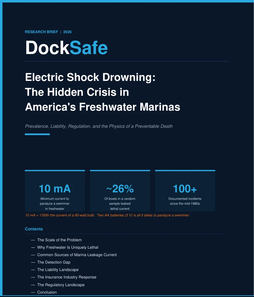
ONE FRESHWATER SURVEY
13
of 50
sampled boats
Reported leaking potentially lethal current
sampled boats
WHY MEASURE THE WATER
Boat testing does not show the full condition of the shared water.
A random survey across three freshwater marinas found potentially lethal current leaking from 13 of 50 sampled boats. It does not establish a universal rate. It shows why direct visibility in shared water answers a different operating question.
Source: DockSafe ESD Research Brief 2026, page 3.
START WITH YOUR MARINA
See what DockSafe would look like around your operation.
Tell us who you are and where you operate. We will use the conversation to understand your marina and show the parts of DockSafe that matter most.
Focused platform walkthrough
Marina specific discussion
A conversation shaped around your marina